
Earthquake Zonation
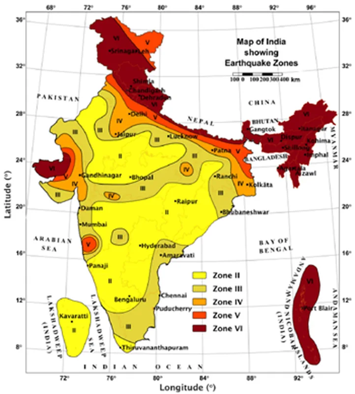
New Quake Map Planned Bureau of Indian Standards released revised Earthquake Design Code, 2025 (IS 1893), introducing new highest-risk Zone VI and placing the entire Himalayan region under it. The updated map places 61% of India’s landmass and 75% of the population under…

New Quake Map Planned
- Bureau of Indian Standards released revised Earthquake Design Code, 2025 (IS 1893), introducing new highest-risk Zone VI and placing the entire Himalayan region under it.
- The updated map places 61% of India’s landmass and 75% of the population under moderate-to-high seismic hazard risk zones. (Earlier, 59% of India’s landmass).
- The previous classification had four seismic zones: Zone II, Zone III, Zone IV, and Zone V. Zone V was earlier the most seismically active, and Zone II the least.
- The Himalayan belt, earlier divided between Zones IV and V, is now placed entirely under Zone VI. This applies from Jammu and Kashmir to Arunachal Pradesh.
- Map is updated using Probabilistic Seismic Hazard Assessment. It considers likelihood & intensity of ground shaking. Revision is based on data on faults, ground-shaking behaviour, tectonic movements, and lithology.
- The revised code lays down standards for both SE design and AEU protection. It aims to reduce damage from ground shaking. The revisions support SDG 9 and SDG 11.
Major Himalayan Fault Systems
- Main Central Thrust (MCT) lies between the Greater Himalayas and Lesser/Middle Himalayas.
- Main Boundary Thrust (MBT) lies between the Lesser Himalayas and Outer Himalayas (Shiwaliks).
- Main Frontal Thrust (MFT) or Himalayan Frontal Fault (HFF) lies between the Outer Himalayas and Northern Indian Plains. HFF is southernmost fault with densely populated foothills.
- The update considers the possibility of southward rupture propagation affecting areas like Dehradun.
Exposure Window and Risk Reduction
- The revised map introduces the concept of an “exposure window”. It considers population density, infrastructure concentration, urban expansion, and socio-economic vulnerability. This uses Probabilistic Exposure and Multi Hazard Assessment method. The approach integrates geological factors with human and economic impacts.
Earthquake Zoning Reverted
- The Centre withdrew the revised earthquake zoning framework after backlash from government departments and infrastructure authorities. BIS had issued a notification to replace IS 1893 (Part 1): 2016.
- The revised notification was withdrawn through a Gazette notification. Objections raised by MoHUA, Metro Rail corporations, and National Dam Safety Authority (NDSA).
- Concerns over increased construction costs due to revised probabilistic seismic hazard assessment (PSHA).
- Over 60% of India’s landmass would fall under moderate to high earthquake risk zones under revised classification.
- Introduction of new highest-risk Zone VI. Parts of Kashmir, North-East and Kutch (Gujarat) placed under highest seismic risk. Himalayan regions categorised under Zone V (very high seismic vulnerability).
- Revised norms would require stronger foundations and structural design changes. MoHUA flagged significant financial implications for infrastructure projects. NDSA raised scientific objections to revised hazard values.
Preparing for UPSC?
Talk to us about the right programme for your attempt.
Keep reading
Related articles
 03
May 2026
03
May 2026
Current Affairs · Geography
Coal Distribution & Types
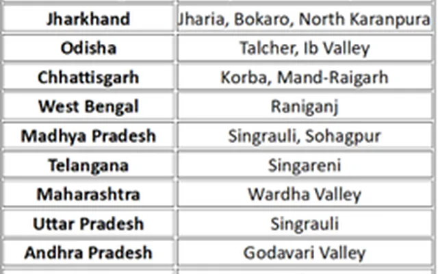
Why in news: Angul district in Odisha is a major hub for coal mining. India's major coal-producing states, consistently leading in output and reserves, are Odisha, Chhattisgarh, Jharkhand, Madhya Pradesh, Telangana, Maharashtra, and West Bengal, with Odisha often topping…
Decode Civils · 3 May 2026
 03
May 2026
03
May 2026
Current Affairs · Geography
Stratospheric Aerosol Injection
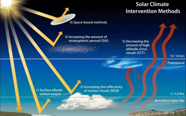
Why in news: SAI involves injecting aerosols into the stratosphere to reflect sunlight and cool the planet. Inspired by volcanic eruptions, which naturally cool Earth by spewing aerosols into the atmosphere. Suggested as a supplement to emissions reductions, not a replacement.…
Decode Civils · 3 May 2026
 03
May 2026
03
May 2026
Current Affairs · Geography
Bharat Forecasting System, IMD & C-FLOOD
Why in news: The government unveiled the new “Bharat Forecasting System” (BFS) for improved weather prediction. The BFS is developed by the Pune-based Indian Institute of Tropical Meteorology (IITM). It will provide weather forecasts with a 6 km resolution, the highest in the…
Decode Civils · 3 May 2026
Our programmes
Courses for your attempt

PSIR EXCELLENCE PROGRAM PRO (OFFLINE): Batch-2
An Enrichment Course that can help you add 50+ marks in your PSIR Scores.

PSIR EXCELLENCE PROGRAM PRO (ONLINE): Batch-2
An Enrichment Course that can help you add 50+ marks in your PSIR Scores.

PSIR EXCELLENCE PROGRAM- BASE (OFFLINE): Batch-2
An Enrichment Course that can help you add 50+ marks in your PSIR Scores.

PSIR EXCELLENCE PROGRAM BASE (ONLINE): Batch-2
An Enrichment Course that can help you add 50+ marks in your PSIR Scores.

Mains Excellence Program Pro for Mains 2027 - Final Batch
Your One-Stop Solution for UPSC 2027 Mains: - MEP Faculties have an experience of 22 UPSC CSE Mains, 10 Interviews and 5 Final Selections. - Faculties include Mudit Jain Sir (AIR-222, 207, 173), Sourabh Arbole Sir (6…
Batch 2027 Starts 14 Sep 2026

Mains Excellence Program Plus for Mains 2027 - Final Batch
Your One-Stop Solution for UPSC 2027 Mains: - MEP Faculties have an experience of 22 UPSC CSE Mains, 10 Interviews and 5 Final Selections. - Faculties include Mudit Jain Sir (AIR-222, 207, 173), Sourabh Arbole Sir (6…
Batch 2027 Starts 14 Sep 2026

Mains Excellence Program Basic for Mains 2027 - Final Batch
Your One-Stop Solution for UPSC 2027 Mains: - MEP Faculties have an experience of 22 UPSC CSE Mains, 10 Interviews and 5 Final Selections. - Faculties include Mudit Jain Sir (AIR-222, 207, 173), Sourabh Arbole Sir (6…
Batch 2027 Starts 14 Sep 2026
Foundation + Advanced Ethics Base (Offline)
Is Ethics Paper Doable via Philosophical Gyan or Specific Thematic Preparation is Needed? Last 5 Years' Analysis & 54 Distinct Themes asked by UPSC answer the above question. Thematic preparation and advanced ethics…
Batch 2027 Starts 14 Sep 2026
Foundation + Advanced Ethics Base (Online)
Is Ethics Paper Doable via Philosophical Gyan or Specific Thematic Preparation is Needed? Last 5 Years' Analysis & 54 Distinct Themes asked by UPSC answer the above question. Thematic preparation and advanced ethics…
Batch 2027 Starts 14 Sep 2026

Foundation + Advanced Ethics Plus (Offline)
Is Ethics Paper Doable via Philosophical Gyan or Specific Thematic Preparation is Needed? Last 5 Years' Analysis & 54 Distinct Themes asked by UPSC answer the above question. Thematic preparation and advanced ethics…
Batch 2027 Starts 14 Sep 2026

Foundation + Advanced Ethics Plus (Online)
Is Ethics Paper Doable via Philosophical Gyan or Specific Thematic Preparation is Needed? Last 5 Years' Analysis & 54 Distinct Themes asked by UPSC answer the above question. Thematic preparation and advanced ethics…
Batch 2027 Starts 14 Sep 2026

Year Long Current Affairs Base (Pre + Mains)
Master Current Affairs the way UPSC demands—through conceptual understanding, issue-based analysis, and exam-oriented preparation. With a proven track record across UPSC and State PSC examinations, our course helps you…
Batch 2027 Starts 16 Aug 2026


0 comments
Discussion
No comments yet. Be the first.